December 18, 2020
My Thoughts on #30DayMapChallenge 2020
On the great journey of pursuing high-end cartography
1442 words | 7-min read |
On the last November, I joined the #30DayMapChallenge by Topi Tjukanov on Twitter. This challenge is nothing but create maps, based on the desired theme each day. The whole challenge is not a competition, yet just for enjoyment for mapmakers all around the globe. You could check the official GitHub repo for more information.
During the whole month, you could find tons of well-crafted and incredible maps on Twitter. I am grateful to have the glamorous altruists all over Twitter to share their maps. Those maps bring my understanding of cartography up to a new level.
I published a total of 13 maps for this challenge. It will be great to find a place to store the maps I made during the challenge. While there’s no place like home, there’s no website like personal blog. I decided to put the maps in here and write a few words to describe what the heck are my maps doing. This will also be a great place to tell some behind the scenes of these maps.
The Maps
I ordered the maps chronologically, which is just the same as the order of the theme in the challenge.
Day 2 - Lines
I have to admit the number of likes and retweets of this first entry are what made me to continue to work on the challenge. I made an old pen-n-ink style map before the challenge, but was never satisfied with the quality of the scale bar. This challenge serves a chance for me to refine it. And at the same time John Nelson published two videos on creating scale bars. What a coincidence!
#30DayMapChallenge Day 2 - Lines
— Kenneth Wong (@Kenneth_KHW) November 2, 2020
Ferry routes in Victoria Harbour, Hong Kong.
A big thanks to @John_M_Nelson’s pen and ink style and the latest video tutorial on designing vintage scale bars! pic.twitter.com/Wff2J55M5D
Day 4 - Hexagon
This map is a slightly modified version of my article Gridify Hong Kong. I thanked myself for exporting the whole ArcGIS Pro project as an package before. It would otherwise be a hard time trying to transform the shape of the points from circle to hexagon.
#30DayMapChallenge Day 4 - Hexagon
— Kenneth Wong (@Kenneth_KHW) November 4, 2020
% of building area in Hong Kong in each 12.5 ha hexagonal grid. Symbolised by the size of hexagons. pic.twitter.com/aatXi65c4P
Day 5-8 - Blue, Red, Green & Yellow
Originally, I want to compare the production between different types of bell peppers (and exclude the theme blue). However, after some random clicks on the USDA database, I realised they do not classify the bell peppers production data by colours. So I switched to mapping fruits of blueberries, strawberries, lime and lemon. I stuck when choosing between strawberry and cherry to map the red though.
#30DayMapChallenge Day 5-8 - Blue, Red, Green & Yellow
— Kenneth Wong (@Kenneth_KHW) November 8, 2020
Total acres of blueberry, strawberry, lemon & pear fields in each county of the contiguous US 🍓🍋🍐
Yep, I am too lazy and decided to bind 4 themes into 1 mapping project. (1/2) pic.twitter.com/fBMs3C2TkE
Day 9 - Monochrome
A small warm-up task for rendering something big with Aerialod. Nothing special.
#30DayMapChallenge Day 9 - Monochrome
— Kenneth Wong (@Kenneth_KHW) November 9, 2020
Sun Moon Lake (日月潭) and surrounding mountains, Taiwan
A quick test of using #Aerialod. Rendered in greyish cyan. pic.twitter.com/2c20mLdSzB
Day 12 - Non-GIS Map
Those good old days when I had access to the laser cutting machines. I can’t afford to buy one just for myself - at least I need to rent a flat in industrial building as my studio to place those large machines.
#30DayMapChallenge Day 12 - Non-#GIS Map
— Kenneth Wong (@Kenneth_KHW) November 12, 2020
Wooden Laser Cut Map of Po Toi Island, Hong Kong
A small experiment when I was obsessed in #lasercutting during postgraduate days. Got no chance to access cutting machines anymore after graduation though. pic.twitter.com/t9BKptWydB
Day 14 - Climate Change
This map is the main dish I created for my article on Medium discussing how sea level rising will affect Hong Kong. So, why not also use this as an entry for the challenge? rayshader saves my life in 3D rendering. This animated map is completely made in R and reproducible.
#30DayMapChallenge Day 14 - Climate Change
— Kenneth Wong (@Kenneth_KHW) November 14, 2020
Short animation showing the submerged land when seawater rises from 0 to 5m above current sea level in Victoria Harbour, Hong Kong. Rendered with #rayshader #Rspatial pic.twitter.com/ETYwYUf3iw
Day 15 - Connections
This is from my old article on Medium (again) Street Suffix in Hong Kong, Mapped. Street names are fun to investigate, especially in a bilingual city. As I already said in the tweet, the order chaos between Chinese and English names (not only street suffixes) will be long-lasting research project for urban historians.
#30DayMapChallenge Day 15 - Connections
— Kenneth Wong (@Kenneth_KHW) November 15, 2020
Roads in Metropolitan Area of Hong Kong coloured by English street name suffix. Data cleaning with #Rstats & mapping with #ArcGIS. pic.twitter.com/PEHmKJQCSH
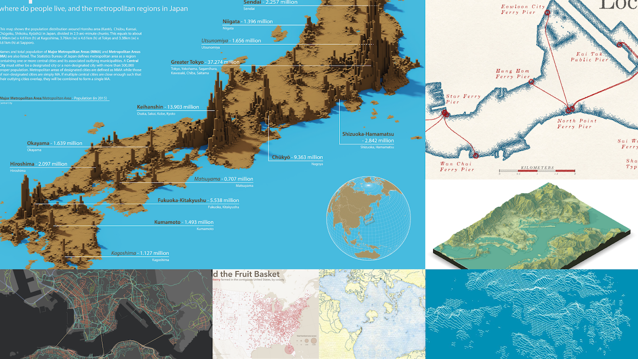
Day 20 - Population
I believe I have to write a long post for this. Never thought I would receive hundreds of likes and nearly 100 retweets! It feels great and no wonder why people will be addicted to social media. The power of likes is fascinating.
This map poster is also the one I have spent the longest time on. Choosing a suitable view angle to view the area of interest is already a challenging task. I then have to choose a some feels-like-you-are-in-Japan colour palette to implicitly show I am mapping Japan. Finally, it takes time to design the population labels and find gaps to place them.
#30DayMapChallenge Day 20 - Population
— Kenneth Wong (@Kenneth_KHW) November 20, 2020
Population distribution (in 0.04-degree chunks) and metropolitan regions in Japan
Rendered with #aerialod. My greatest gratitude to @undertheraedar for writing a bunch of tutorials for this tremendous software. pic.twitter.com/AWwboLGp7M
Day 21 - Water
At first I just want to try Spilhaus projection. I then realised using watercolour style may be a good idea.
#30DayMapChallenge Day 21 - Water
— Kenneth Wong (@Kenneth_KHW) November 21, 2020
Water bodies of the world, in watercolour style. Also time to have some Spilhaus projections. pic.twitter.com/JS4EbKh0C1
Day 24 - Elevation
Who doesn’t love joyplot? It’s simple while keeping the elevation and general topographical features of the area. Joyplot itself fits the minimalism ideology well. Restricting the colour use to black/white or monochrome helps make the subject speaks for itself.
#30DayMapChallenge Day 24 - Elevation
— Kenneth Wong (@Kenneth_KHW) November 24, 2020
A simple joyplot showing the relief of Hong Kong. pic.twitter.com/XLIG02EpRm
Ideas left behind
TBH, I would like to participate in more days if I had time. Before the challenge, I even created a note to think about what maps I could make for each topic.
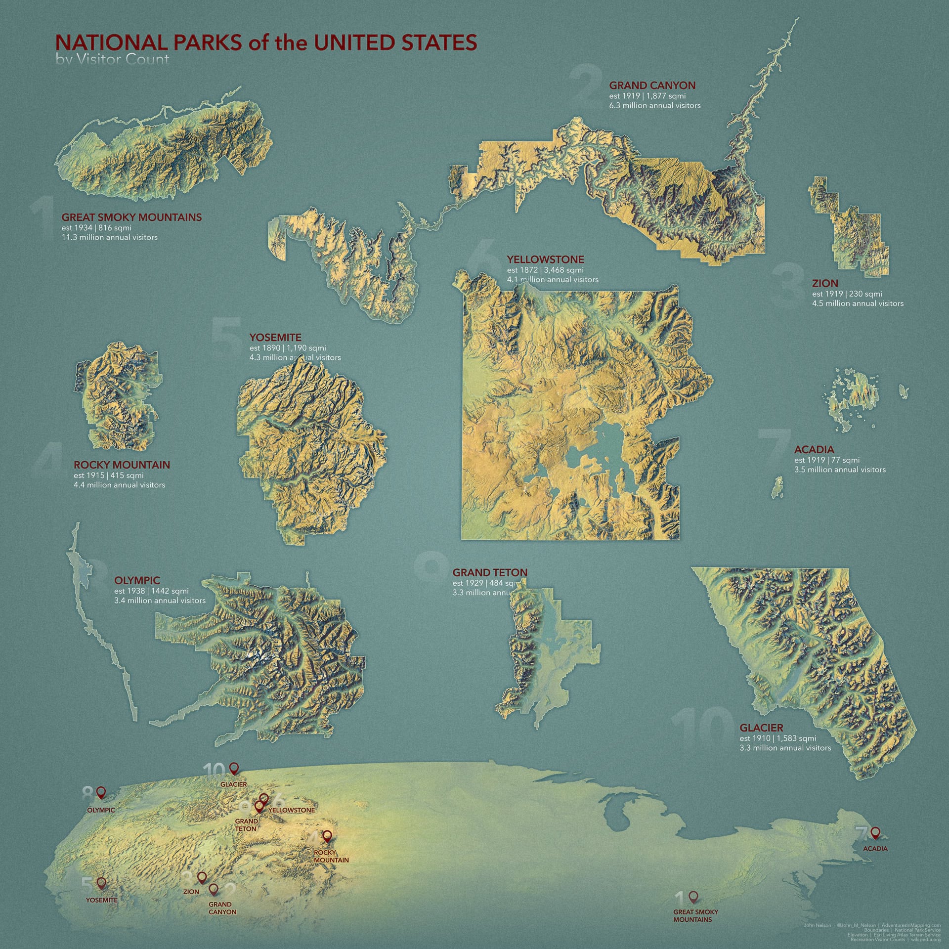
For Day 16 - Islands, I thought of mapping the 10 largest islands in Hong Kong, just like John Nelson’s big fat poster of National Parks. Who would not like map posters? There are more than 200 small islands scattering around the territory of Hong Kong, and ordering them by size could be interesting.
The idea of NULLah in Day 19 - NULL was one of my first brainstormed ideas specifically for this challenge. Unfortunately, I do not have time to do those tedious data cleaning tasks to select all nullahs in Hong Kong. What a pity.
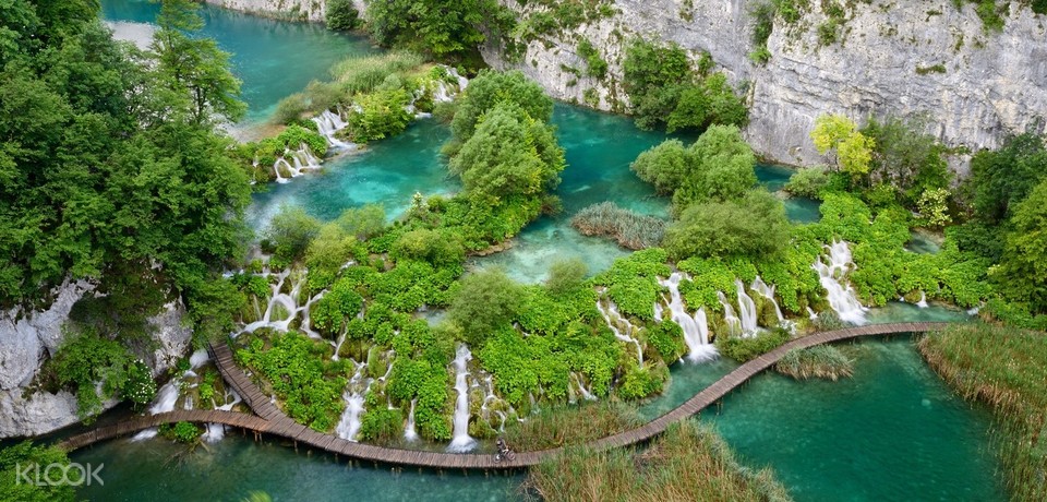
I originally planned to map Plitvice Lakes for Day 21 - Water. I went there in 2015 and could still remember how I was flabbergasted by the picturesque nature.
For Day 23 - Boundaries, I would like to use census data to make some gifs to discuss pros and cons of choosing different types of boundaries (District, Planning Unit, Street Block, Square Grid, Hexagonal Grid, etc.). The census boundary are, in the end, notorious for their strange shapes and funny cutting methods.
I also thought of mapping something around Antarctica for Day 29 - Globe to have a try on dealing with projections near the poles. And obviously I did not make it.
Concluding Marks
#30DayMapChallenge is a great, awesome challenge for the whole twitter cartography community. The GIS and cartography community in Twitter is terrific - lots of great mapmakers sharing their products and thoughts on the timeline.
Finally, this repo have a smart way to summarise the whole Twitter cartography community efforts. It is my greatest honour to participate in this challenge :).
